
REVIEW · SANTIAGO ISLAND TOURS
Santiago: Monte Tchota Natural Park to Pico d’Antónia Hike
Skyline views start with hard steps. This Cape Verde hike pairs Monte Tchota Natural Park with the climb to Pico d’Antónia, Santiago’s top peak, for panoramas that can reach across islands. I like the mix of cooler, biodiverse hiking in the park and the straightforward, get-it-done rhythm up to the summit.
One thing to be aware of is the difficulty. This is a difficult trek with a narrow, sometimes tilted path, about a 9 km one-way distance, and real elevation work.
In This Review
- Key things that make this hike special
- Monte Tchota to Pico d’Antónia, the hike that earns its altitude
- Entering Monte Tchota Natural Park, cool air and real biodiversity
- The rise toward Santiago’s highest point at Pico d’Antónia
- Panoramas you can use, Santiago cities and distant islands
- Trail facts, what “difficult” means in your legs and your head
- Getting a guide you can trust on a narrow path
- Picnic fuel that actually helps during the summit stop
- Timing and transport, the part people underestimate
- Price and value, why $100 can make sense for this kind of trek
- Who should book Pico d’Antónia with this park hike, and who should skip
- Should you book this Monte Tchota to Pico d’Antónia hike?
- FAQ
- How long is the hike and tour day?
- How difficult is it?
- What are the trail distance and elevation details?
- Do I get pickup and drop-off?
- What’s included in the picnic?
- What languages do the guides speak?
- What should I bring?
Key things that make this hike special
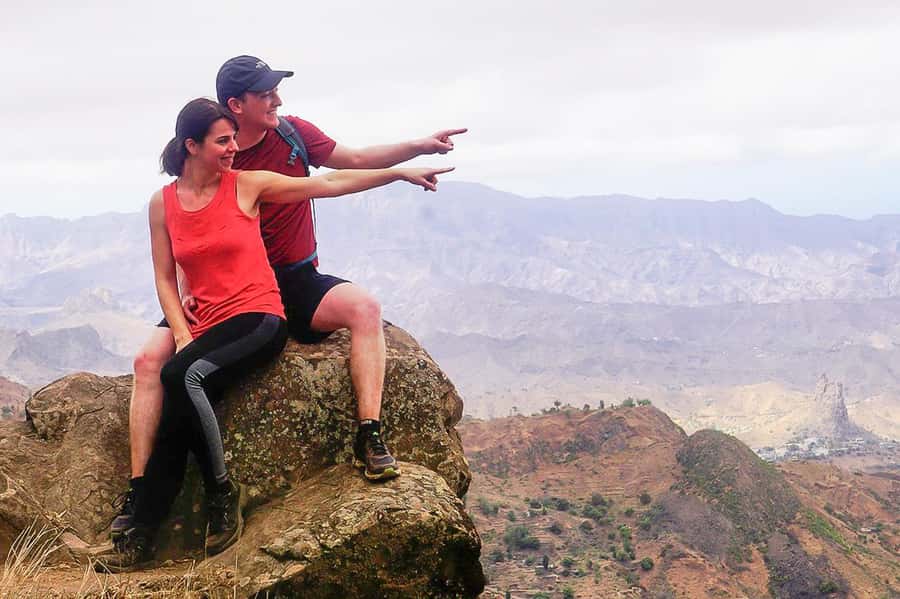
- Pico d’Antónia views: Santiago’s cities plus distant sights to Maio and Fogo when weather clears
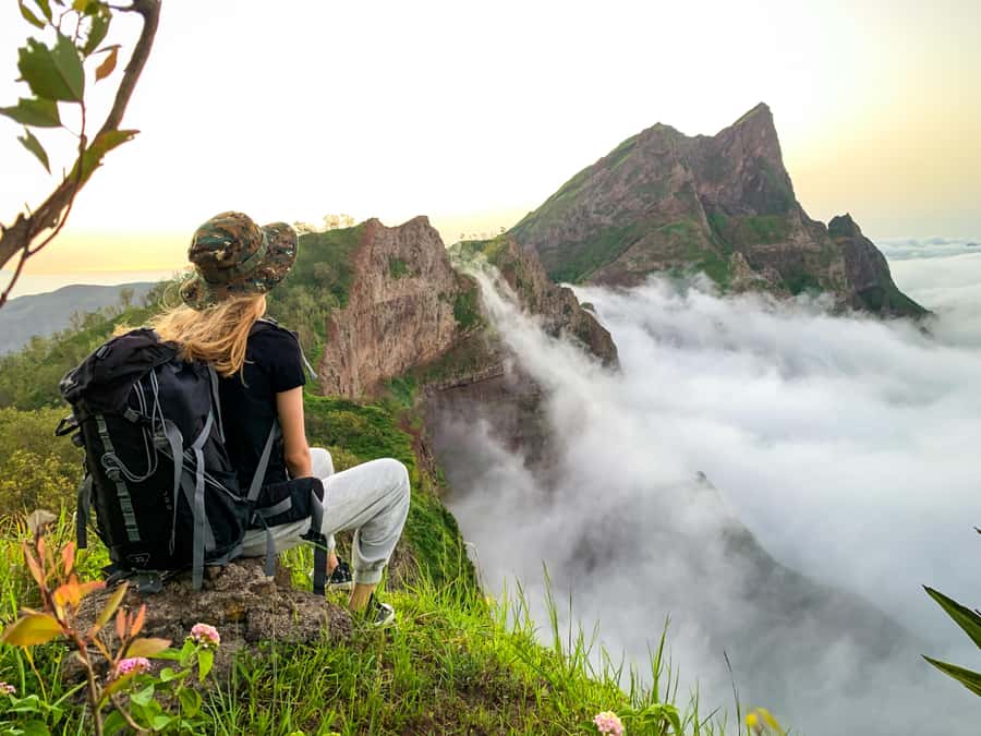
- Monte Tchota micro-climate: cooler air than many other parts of the island, with lots of biodiversity
- Difficult but guided well: a guide who paces the group and stays focused on safety
- Real summit payoff: a tough finish followed by big-picture valley and horizon views
- Value extras: transport, pickup and drop-off, and a picnic included
Monte Tchota to Pico d’Antónia, the hike that earns its altitude
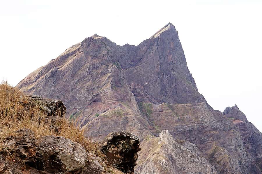
This is the kind of hike that feels like it has a mission. You start in the Rui Vaz area, then you work your way through Monte Tchota Natural Park before pushing up to Pico d’Antónia, the highest point on Santiago Island.
What I like most is that the day has two moods. First, you’re moving through a cooler, greener pocket of the island, not just walking in dry sun. Then you switch into high-wind, high-altitude mode where the whole island starts to show itself.
You’ll also appreciate the built-in structure. Expect a small picnic stop with time to look around, not just a sprint to the top. That break matters here because the trail is demanding, even when you’re moving steadily.
Entering Monte Tchota Natural Park, cool air and real biodiversity
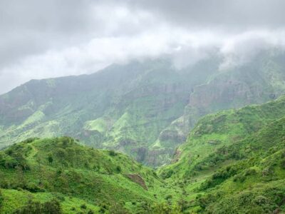
Monte Tchota Natural Park sits around 800 meters and has its own micro-climate. Translation: you may get noticeably cooler conditions than you’d expect lower on Santiago, which makes the hike feel more manageable.
As you climb inside the park, you’re not just collecting elevation. You’re walking through a more varied environment, and that biodiversity angle is part of the appeal. It’s the rare hiking day on Cape Verde where you can actually feel the habitat change as you go up.
There’s also a practical side to the park setting. A cooler start can help you settle into your pace early, especially if the day is sunny. If you can, go into the hike calmly, because the trail still has a narrow, sometimes tilted feel that requires attention.
Santiago in other shapes, coast and interior
- Santiago: Calabaceira Valley Trek & Visit to Cidade Velha★ 4.8 · 49 reviews
- Santiago: Monte Tchota Natural Park to Pico d’Antónia Hike★ 4.8 · 43 reviews
- Discover Santiago island in 1 day★ 5.0 · 39 reviews
- Santiago Island: 4-Hour Calabaceira Valley Hike & Guided Tour to Cidade Velha★ 5.0 · 18 reviews
- Private Tour of Santiago – Discover the Island★ 4.5 · 18 reviews
The rise toward Santiago’s highest point at Pico d’Antónia
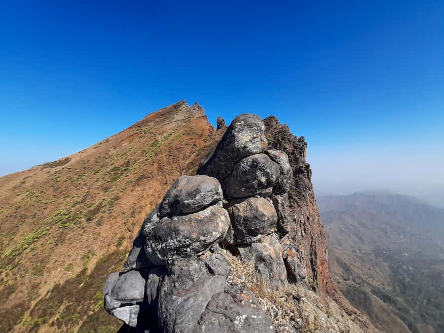
Once you leave the lower park segments behind, the hike shifts toward the summit push. Pico d’Antónia reaches about 1,394 meters, and that height change is what turns a good walk into a serious hike.
You’ll likely feel the grade most when you get closer to the top. That’s also where the payoff starts to show, because the views begin opening up toward the São Jorge Valley.
Here’s the smart way to tackle it: don’t race. Pick a steady effort you can maintain for hours. The reviews attached to this experience highlight guides who keep groups moving at a pace that feels safe and doable, and that matters on a trail you can’t treat like a flat path.
Panoramas you can use, Santiago cities and distant islands
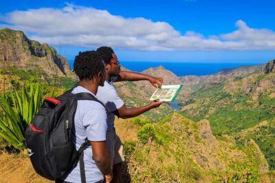
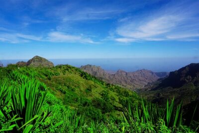
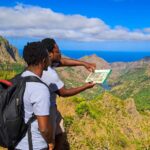
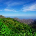
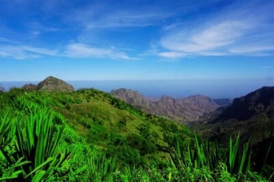
At the summit, the goal is simple: look far. From near the top, you can see across the São Jorge Valley, and in good weather you may catch sight of Maio Island and the volcano of Fogo in the distance.
The key word here is weather permitting. On clear days, the horizon helps you understand Santiago’s layout, and you get that satisfying feeling of seeing the island from the right angle. On hazy days, you still get a sense of height and direction, but the distant island views might not cooperate.
This is also why the small picnic stop is more than a snack. It gives you time to orient yourself. When you can point and say, I’m looking over that valley, your effort feels more meaningful.
Trail facts, what “difficult” means in your legs and your head
Let’s make this real and practical. The trek is about 9 km one-way, with walking time around 4 to 5 hours. Plan on more than that for the full half-day experience because you’re also dealing with the drive, the picnic, and time to pause for views.
The elevation numbers are big enough to take seriously. You’re climbing roughly 660 m toward the high point around 1,400 m, and the overall elevation loss is listed as about 1,280 m. That combination is what makes the hike tiring even if the top section isn’t always the longest.
The trail quality is another factor. It’s described as narrow and sometimes tilted. That means your footing matters, especially if you’re tired later in the day. Some segments may require level 1 climbing, so don’t plan on flip-flops or slick shoes.
What you should do before the hike:
- Wear hiking shoes with grip and support.
- Bring water and drink even before you feel thirsty.
- Use a sun hat and sunscreen, because the hike is still exposed in many places.
- Consider hiking pants, especially from August to November when conditions can be tougher (you’ll be happier with coverage).
And if you like a little extra stability, bring walking sticks. The guidance specifically encourages them since some sections may call for an extra hand on the slope.
Getting a guide you can trust on a narrow path
This hike leans on human help. A good guide isn’t just giving directions, they’re reading the trail and managing the group.
One reviewer specifically praised the guide named Elder, calling out his helpfulness, empathy, and easy, clear explanations about nature along the way. That same feedback also highlighted safety focus during harder moments, which is exactly what you want on a narrow, tilted trail.
Guide quality shows up in small ways. One key theme in the feedback is pacing, with the guide moving mostly at the group’s speed. That reduces the risk of everyone burning out too early, especially during the steeper sections toward Pico d’Antónia.
You’ll also get multi-language support. Tours run with a live guide in English, French, Spanish, or Portuguese, so you can actually follow what’s happening instead of just managing your breath.
Other climbs into the Santiago highlands
Picnic fuel that actually helps during the summit stop
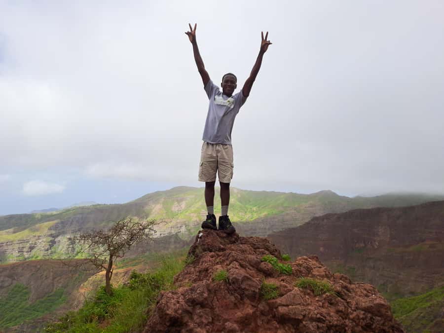
The included picnic is light, but it’s strategically timed. You get soft juice plus a sandwich and fruit. That’s enough to refresh you for the remaining climbing work and the return segments.
This matters because the day is not just a single steady effort. There’s a summit push, a view pause, then the walk back through the park area before your ride returns you to your hotel.
Bring your own drinks too, even if the picnic includes juice. The guidance explicitly recommends bringing drinks and water. I think of it as insurance: you can start hydrated, sip steadily, and avoid the “last hour scramble” that hits on difficult hikes.
Timing and transport, the part people underestimate
The full experience lasts about 6 hours. The hike itself is about 4 to 5 hours of walking time, plus time spent driving to the trail start area and back.
Pickup and drop-off are included if you’re staying in Praia or São Jorge dos Órgãos. If you’re elsewhere on Santiago, you’ll need to pay an extra pickup and drop-off fee.
This is one reason the tour format is good value for many people. The trail start isn’t something you just wander into from the beach, and the transport removes stress from your day plan. You can focus on the hike instead of figuring out local routes and timing.
Also, note the pickup behavior: you’ll be asked to wait in your hotel lobby about 10 minutes before pickup. The driver will hold a sign with your last name on it, and they’ll wait no longer than 5 minutes past the scheduled time. Set your expectations and be ready, and it’ll feel smooth.
Price and value, why $100 can make sense for this kind of trek
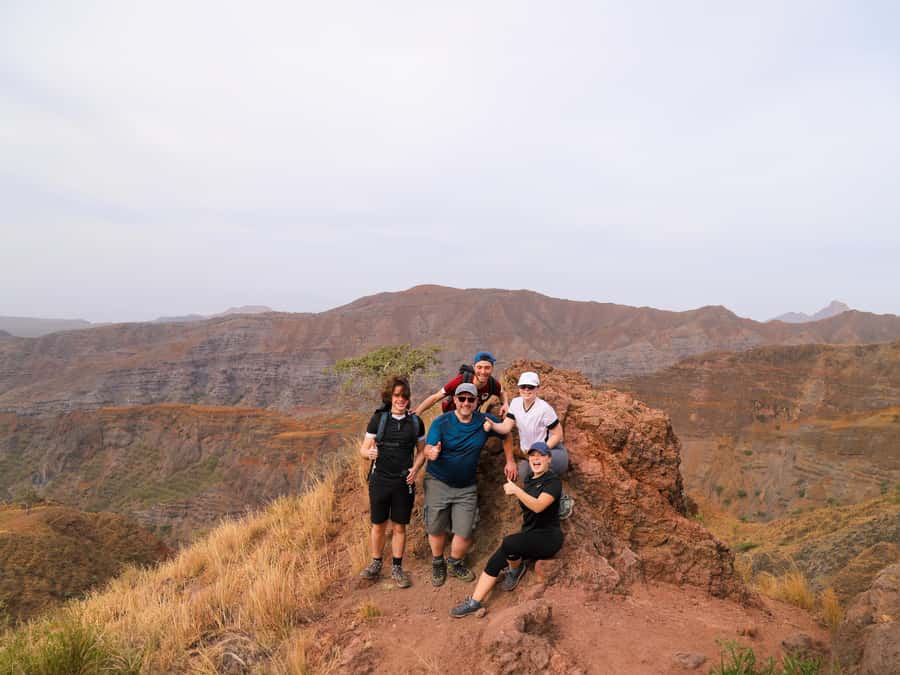
At about $100 per person for a roughly 6-hour experience, you’re paying for more than a guide and a walk. You’re also getting transport, pickup and drop-off (in the included zones), guide support in several languages, liability insurance, and a picnic.
For a difficult hike with a narrow trail and uneven footing, the guide portion matters. In places like this, local expertise is also about safety management and knowing how to keep a group moving.
The $100 price starts to look more reasonable when you compare it to the cost of separate transport plus the cost of a guide. Here, you’re bundling the hard parts into one plan. That can be a big deal if you want your hiking day to stay predictable.
If you’re traveling on a tight schedule and want to climb Santiago’s highest point without extra coordination, this is the kind of organized half-day that tends to be worth it.
Who should book Pico d’Antónia with this park hike, and who should skip
This hike is a strong fit if you:
- Have some fitness and want a real challenge
- Are comfortable walking about 9 km one-way with significant elevation
- Prefer a guided experience on narrow, tilted paths
- Want a day where the effort is rewarded with views over Santiago’s valley and possible distant islands
It’s not a good match if you:
- Are pregnant
- Have mobility impairments or need wheelchair access
- Have respiratory issues
There’s also a minimum age: it’s for travelers over 16 years old. If your group includes teens who can handle steep walking, this could work well as a structured adventure day.
If you’re the type who likes to take photos but also wants to actually earn them with walking, you’ll probably love this day. If you want an easy stroll, you’ll feel the difference fast.
Should you book this Monte Tchota to Pico d’Antónia hike?
I’d book it if you want the best combo of Santiago’s highest viewpoint and a guided climb through Monte Tchota’s cooler natural environment. The included transport and picnic make it practical, and the guide focus on pacing and safety adds comfort for a tough trail.
Skip it and look for something easier if you know narrow, tilted trails and steep elevation are a challenge for your body right now. The day can end up feeling hard, and the experience is designed for walkers who are ready to work.
If you book, plan for real hiking shoes, water, and sun protection. Treat the summit as the goal, not the starting point, and you’ll get more than a view. You’ll get a sense of perspective over nearly all of Santiago, and when the weather behaves, even far-away Cape Verde landmarks.
FAQ
How long is the hike and tour day?
The total experience runs about 6 hours. The actual walking time is about 4 to 5 hours, with time for the picnic and viewpoints.
How difficult is it?
It’s marked as difficult. It’s suitable for walkers with some fitness and no health problems, and it includes significant elevation changes and a narrow, tilted path.
What are the trail distance and elevation details?
The trek distance is about 9 km one-way. Elevation gain is about 660 m, the maximum elevation is around 1,400 m, and the minimum elevation is around 485 m. Elevation loss is listed as about 1,280 m.
Do I get pickup and drop-off?
Pickup and drop-off are included if you’re staying in Praia or São Jorge dos Órgãos. If you are not in those areas, you’ll be required to pay an extra fee for pickup and drop-off.
What’s included in the picnic?
The picnic includes soft juice, a sandwich, and fruit.
What languages do the guides speak?
The live tour guide is available in English, French, Spanish, and Portuguese.
What should I bring?
Bring a sun hat, hiking shoes, sunscreen, water, and drinks. Hiking pants are strongly advised, especially from August to November. Walking sticks may also help on sections that require level 1 climbing.
All Our Cape Verde Reviews

Serra Malagueta and Pico de Antonia
Santiago Island, More Routes

More Cape Verde tours from the same review pile
- Hiking Águas Belas Cave
★ 4.5 · 3 reviews - Santiago Island: Private Airport Transfer to Praia or Vice Versa
★ 5.0 · 3 reviews - Best of Santiago Island: Cidade Velha, Workshop & Tarrafal Beach Tour
★ 4.5 · 3 reviews - Cape Verde: Best Hikking Trails of Santiago Island – 6 Days
★ 5.0 · 3 reviews - Praia: Plateau and Cidade Velha Guided Tour
★ 5.0 · 3 reviews - Praia City Tours
★ 3.4 · 3 reviews
Santiago Island Tours, compared.
 ★ 4.8Praia: Santiago Island Tour with Tastings and Tarrafal BeachFrom $76416 reviews
 ★ 4.8Santiago: Landscapes, Street Art, and Markets Day TripFrom $70316 reviews
 ★ 5.0Santiago Island Tour: Meet with a Local Family & Tarrafal BeachFrom $103127 reviews
 ★ 4.9Santiago Island: Highlights of Cidade Velha with Local GuideFrom $5767 reviews
 ★ 4.8Santiago Island: Serra Malagueta & Tarrafal Beach Trek TourFrom $10661 reviews
 ★ 4.8Santiago: Calabaceira Valley Trek & Visit to Cidade VelhaFrom $8249 reviews
 ★ 4.6From Praia: Santiago Island Highlights TourFrom $10640 reviews
 ★ 5.0Discover Santiago island in 1 dayFrom $9239 reviews
Browse the lists this tour appears in